How to Use Smith Mountain Lake Channel Markers (2026)
This page may contain affiliate links. If you click and purchase, we may earn a small commission at no extra cost to you. Read our full disclosure policy.
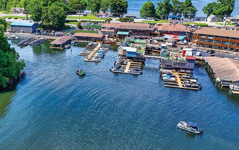
Navigating Smith Mountain Lake isn’t just about operating the boat. It requires an understanding of the lake’s comprehensive channel marking system.
This thoughtfully-designed network guides boaters along the Roanoke and Blackwater River channels and through major creeks like Craddock, Witcher, Walton, Gills, Bull Run, Little Bull Run, Lynville, Grimes and Beaverdam, helping ensure safe and confident exploration of SML’s scenic waters.
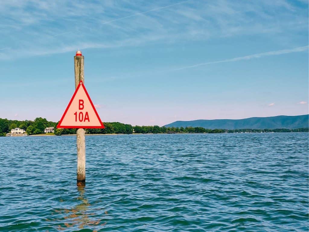
There are numbered and lighted channel markers mounted on pilings along these waterways. When traveling upriver (away from the dam), keep the triangular, even-numbered RED markers to your vessel’s RIGHT (starboard). A helpful mnemonic is “Red on Right Returning,” where “Returning” means traveling upriver toward the river’s source (and NOT back toward the dock, ramp or marina where you started!).
These markers flash red lights at night or during heavy fog and other low-visibility conditions.

Insider Extra: Whenever channel markers are flashing, a boat underway must show its running lights.
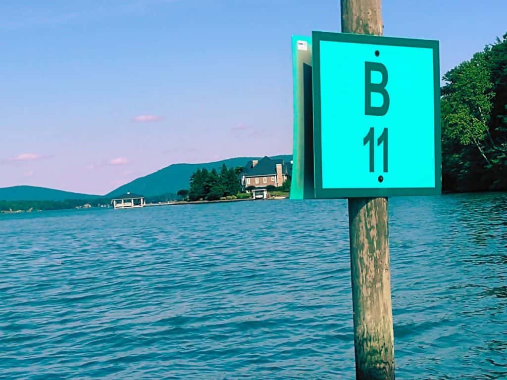
In contrast, square odd-numbered GREEN markers should be kept to your LEFT (port) side when heading up-river. These markers flash green lights after sunset and in other periods of low visibility.
Heading downriver (toward the dam), you simply reverse the process. Keep RED markers to your LEFT and GREEN markers to your RIGHT.
Marker #1 for each channel is closest to the dam, with numbers increasing sequentially as you move upstream. Note that on the Blackwater River, B25, B23 and B21A are currently found a bit upriver from B26, B24 and B22 respectively (though this is scheduled to be “fixed” in the near future).
Additionally, some locations may skip numbers: for example, there’s no R10 between R8 and R12.
New in 2026: “Channel Junction” or “Preferred Channel” Lateral Markers
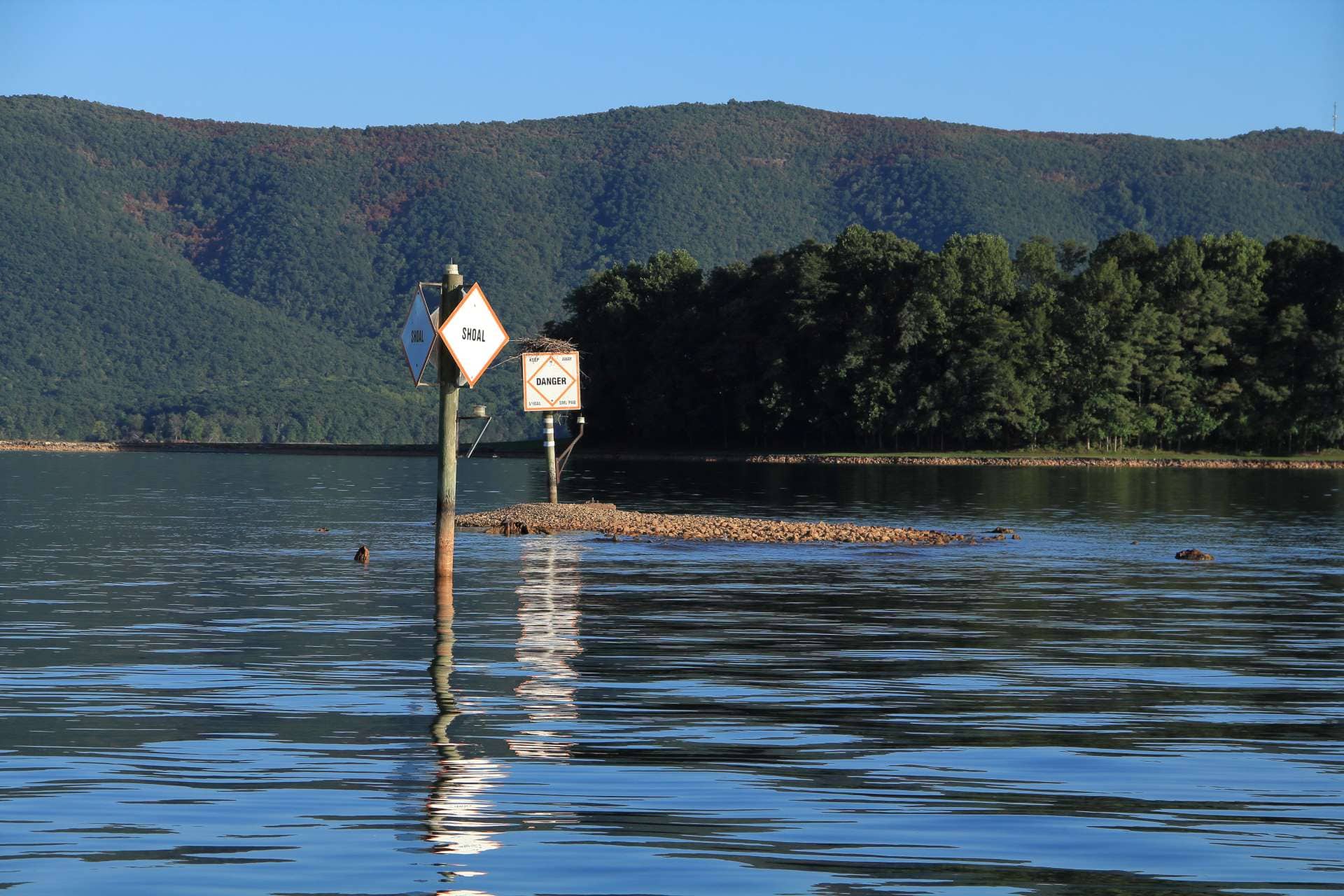
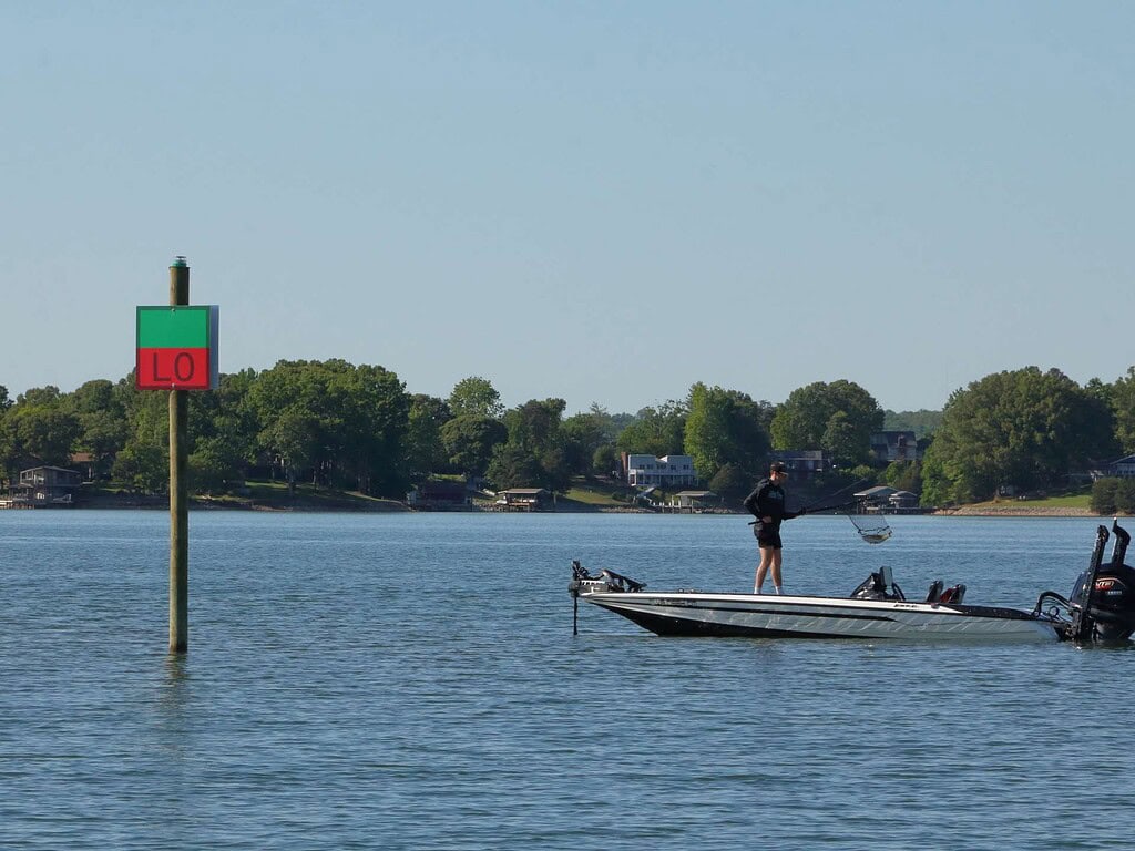
To improve safety and align with U.S. Coast Guard regulations, new Preferred Channel markers (also called Channel Junction markers) have been installed at three locations where a secondary channel branches off the main channel.
These markers are either triangular (with RED as the top color panel) or square (with GREEN) on top.
The top color panel is the main channel indicator. If it is red, keep it to starboard to proceed further upstream along the main channel (RED on RIGHT RETURNING).
If the top section is GREEN, keep it to your left to continue upstream along the main channel. The bottom colored panel serves as the initial lateral marker in the secondary channel.
Here are more details on each of the three new Channel Junction markers:
Louse Creek/Roanoke River (behind Vista Pointe)
A green-over-red square marker labeled LO has been added here. To continue along the main Roanoke channel traveling upstream, leave it to your left. Heading into Louse Creek (toward SM Dock marina), leave it to your right.
Lynville Creek/Roanoke River
Near the mouth of Lynville Creek, new marker RC (square, green-over-red) replaces R61. It tells boaters heading upstream on the Roanoke channel to leave it to their left; leave it to the right to enter Lynville Creek. NOTE: A new R63 has been added just upstream to help guide main channel boaters around the next bend.
Gills Creek/Blackwater River
Former marker G1 has been replaced by a red-over-green triangle labeled BG. To continue on up the Blackwater channel, keep it on your right; to enter Gills Creek leave it to your left. NOTE: A new G2 warns of shoals along the opposite shoreline; the former G2 is now labeled G2A.
Lights on all three Prefered Channel markers match their top panel color and flash in a distinctive 2 + 1 pattern: two quick flashes, then a brief pause followed by a single flash.
Additional SML Channel Marker Updates
Roanoke River
- The shoal marker just downriver from Carter/Emerald Island has been augmented by a new marker, R12. The previous R12 near the island is now R12A.
- At Strawberry Banks, markers S1 and S2 have been added to complement two shoal markers that remain in place.
- Near R33, two temporary green buoys have been added to steer boaters away from the shallows at the tip of Long Island.
- R37 near Indian Creek has been moved to better direct traffic around a prominent peninsula and I1 (“I – One”) replaces a shoal marker in Indian Creek.
Blackwater River
- CB2, a new red daybeacon, denotes the entrance to Cool Branch, replacing a shoal marker. Use caution here: this marker designates Cool Branch, and boaters headed upstream on the Blackwater will leave it well to their left (port) side as they round B2 and B4.
- Lateral marks B5 and B7 have replaced the shoal buoys distantly across from B4 and B6.
- B10B now helps boaters stay clear of an unnamed island near Key Lakewood.
- B26A has been removed to create a more direct sightline to B28.
- B49 has been removed due to inadequate water depth.
- Lateral marks B5 and B7 have replaced the shoal buoys distantly across from B4 and B6.
- B10B now helps boaters stay clear of an unnamed island near Key Lakewood.
- B26A has been removed to create a more direct sightline to B28.
- B49 has been removed due to inadequate water depth.
Craddock Creek
The shoal-dotted shoreline across and upcreek from C1 now has two new lateral marks labeled C2 and C2A. The former C2 (near the tall lighthouse) is now labeled C2B.
Gills Creek
- As noted above, Preferred Channel marker BG has replaced G1.
- G2 is renamed G2A and a new G2 has been added closer to the creek’s mouth to help keep boaters avoid shoals in that area.
What Are the Channel Markers on Smith Mountain Lake?
Markers on Smith Mountain Lake are placed for optimal visibility rather than to indicate distance—thus they are NOT “mile markers.” For example, B2, B4 and B6 encircle a point at the first bend of the Blackwater River and are only about 150 yards apart. (FUN FACT: On Leesville Lake, markers are indeed placed at one-mile intervals).
It’s wise to give all markers a wide berth. Lights can sometimes fail and buoys may be displaced by wind or collisions. Use a chart to verify what you observe on the water.
Markers also include letters before or after their numbers to denote the channel or creek they mark:
R – Roanoke River
B – Blackwater River
W – Witcher Creek
WC – Walton Creek
C – Craddock Creek
H – Hatcher Creek
BU – Bull Run
BR – Little Bull Run
LO – Louse Creek
LC – Lynville Creek
BE – Beaverdam Creek
G – Gills Creek
Report missing markers, light outages or other safety issues to TLAC at (540) 721-4400 or [email protected].
Long-time SML boaters may recall the challenges of navigating the lake back when markers were sparse. Over the years, more than 200 authorized navigational aids have been added. Appalachian Power Company maintains these markers on main channels and creeks, while the Tri-County Lake Administrative Commission (TLAC) oversees shoal, and obstruction and no-wake buoys elsewhere.
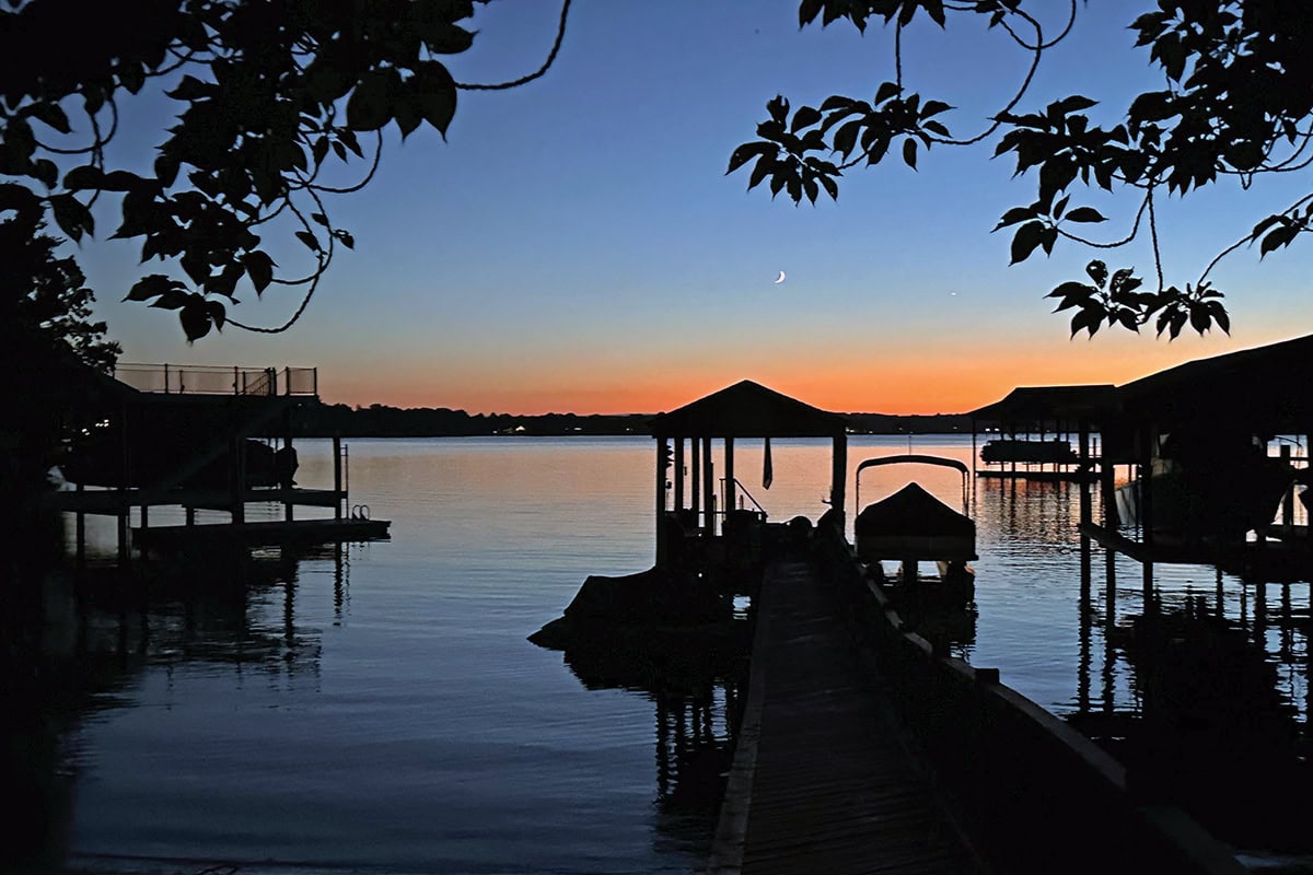
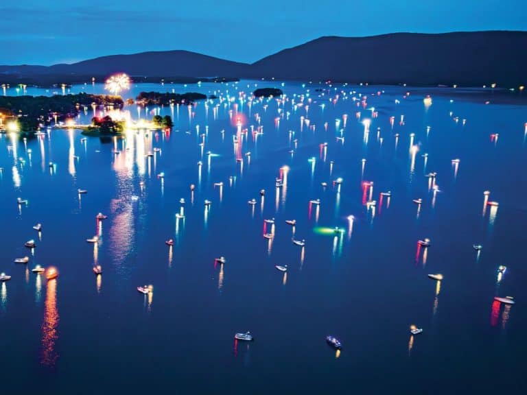
Use Extra Caution When Boating at Night on Smith Mountain Lake
Despite a robust marking system, boaters must stay alert to avoid disorientation—especially after dark. Meandering shorelines and obstructed lines of sight can make navigation tricky, even in familiar areas.
An onboard GPS app is an invaluable tool, particularly for newcomers. While standard smartphone maps usually don’t display navigational markers or hazards, specialized boating apps offer helpful features such as a compass, GPS coordinates, weather updates and more. Examples include Navionics, iNavX and Garmin ActiveCaptain.
Remember, navigational markers have red or green flashing lights at night, corresponding to their colors, and white flashing lights mark some shoals. Additionally, white cylindrical buoys designate swimming areas, shoals and no-wake zones. It’s crucial to stay away from shoal markers and avoid cutting between a navigational marker and the shore.
Insider Extra: 16 Expert Tips for Boating at Night on Smith Mountain Lake
What is the Speed Limit on Smith Mountain Lake?
Smith Mountain Lake has no set speed limits for boats, but safety and courtesy demand the use of common sense when it comes to speed.
Slow down in heavy traffic areas (near marinas, in the “S Curve,” where “Caution: Congested Area” signs are mounted below lateral markers, etc.) and stay right near blind curves. Always throttle back if unsure.

SML Map with Channel Markers
For a successful boating experience, purchase and study a waterproof map of Smith Mountain Lake, available through the Smith Mountain Lake Association. Proceeds directly support the organization’s programs that help keep SML safe and clean.
NOTE: The 2026 marker updates described above are NOT YET REFLECTED on those maps. That is expected to be resolved by year’s end.

Jerry Hale
STAFF WRITER
When he’s not writing about the Smith Mountain Lake, you might just find Jerry out wake surfing or just idling through its coves, practicing guitar or banjo on his deck at the Cottages of Contentment Island, playing steel drums or volunteering with LCM, Trinity Ecumenical Parish, Neighbors Helping Neighbors or the SML Charity Home Tour.