Smith Mountain Lake Guide to Marinas and Public Boat Ramps (2026)
This page may contain affiliate links. If you click and purchase, we may earn a small commission at no extra cost to you. Read our full disclosure policy.
Familiarizing yourself with Smith Mountain Lake marinas and public boat launches is essential, whether you’re setting off for a leisurely cruise or a day packed with water sports excitement.
Drawing from my decades of experience boating on Smith Mountain Lake, I’ve compiled this comprehensive Insiders’ Guide to SML Marinas. It’s filled with invaluable insights to enhance your experience on Smith Mountain Lake, making it both memorable and stress free.
Conveniently organized by location, this guide covers marinas at Hales Ford Bridge, up the Roanoke River, down the Roanoke River, Craddock Creek and Blackwater River. Let’s dive in and make the most of your time on the lake!
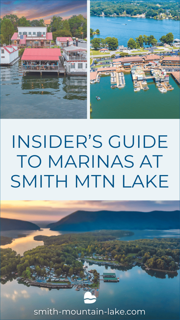
Smith Mountain Lake Marina Guide
Click a link below to jump to marinas in that section.
There are four marinas clustered near the bridge at channel marker R28, two on each side of Virginia 122 at both the north and south ends.
Marina 66/SML Recreational Boat Rentals | R28
Now in its second year at the south end of Hales Ford Bridge (up-river side), Marina 66 is home to an attended gas dock (9 a.m. to 6 p.m. Monday through Saturday and Sundays noon to 6) and a marina store with plenty of bait-and-tackle supplies. Proprietors (and sisters) Abigail Wilson and Emily Dameron also operate SML Recreational Boat Rentals which features classy Crest LX tritoons at two locations (Marina 66 plus Gills Creek Marina partway up the Blackwater). A short walk on shore leads to a a retail store offering water toys, outdoor furniture, umbrellas, dock decor and more, plus and Nautical Bowls, which specializes in smoothies and acai bowls made with fresh ingredients. Note: Wake wash can be heavy at this location, especially on weekend afternoons, so approach the docks with lines and fenders at the ready.
CONTACT:
540-420-8103 ![]()
16525 Booker T Washington Hwy, Moneta, Virginia 24121
Franklin County
Boating
Webster Marine Center | R28
Webster, located at the north end of Hales Ford Bridge, offers gas 24/7 in a mini-cove just upriver from the bridge plus limited transient docking for boaters wishing to access the marina store. The store stocks marine accessories such as life jackets, anchors, hardware, outboard and PWC oil, maintenance items, hats, and logo T-shirts, but no food or beverages other than bottled water. Established in 1966 and family owned, Webster is a prominent dealer of Sea-Doos and Bennington pontoons/tritoons as well as Nautique and Moomba. wake sports towboats. Hours of operation: Mon.-Fri., 8 a.m.-5 p.m.; Sat. 8 a.m.-3 p.m.; closed Sundays.
CONTACT:
540-297-5228 ![]()
1185 Mills Road, Moneta, Virginia 24121
Franklin County
Boating
Waterwheel Marina | R28
Waterwheel is also at the north end of Hales Ford Bridge, but on the down-river side. It is a private marina offering covered, lift-equipped slips by annual contract. There are no retail services on the marina site, but neighboring boat dealer Magnum Boating, Inc., offers sales and service for Chaparral family runabouts, Harris and South Bay tritoons and Robalo fishing boats. There is also a launching ramp concession adjacent to the showroom, with annual, weekly and daily ($20 by monitored honor system) rates posted.
CONTACT:
540-721-5668 ![]()
1227 Waterwheel Drive, Moneta, Virginia 24121
Bedford County
Boating
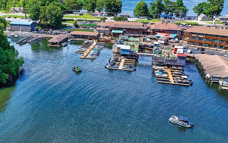
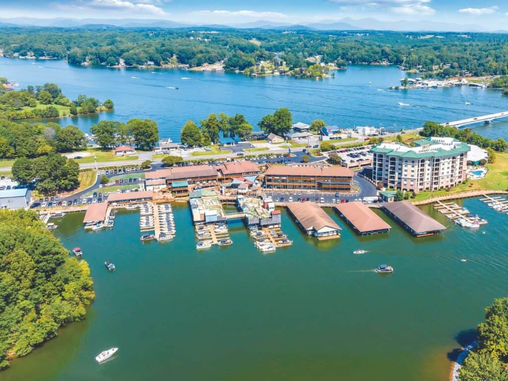
Bridgewater Marina | R28
At the south end of Hales Ford Bridge sits SML’s largest and most diverse marina. Upon entering the no-wake marina cove, ample transient docking is available to starboard. Bridgewater Plaza boasts around 40 shops and eateries, along with recreational activities like a climbing wall and over-water mini-golf course during the season. The full-service marina, open year-round, is situated further in and features the lake’s largest marina store, stocked with water sports necessities, souvenirs and sportswear. Marine-grade fuel is accessible at a dock beyond the covered slips, with attentive dock hands available from 10 a.m. to 8 p.m. daily and tap-to-pay options during off-hours. Bridgewater offers a large boat rental and sales operation with tritoons, runabouts, wake surf boats, fishing boats and PWCs. Reservations are a must in season. The company operates three satellite rental locations in season at Bernard’s Landing, SML State Park and Mariners Landing.

Bridgewater Marina Insider Tip: When rental boats are out, there will be several empty slips that allow an easy visit to the marina store. Purchase some popcorn to feed the huge carp that hang out around the docks. All proceeds from popcorn sales benefit Make-A-Wish Greater Virginia.
CONTACT:
540-721-1639 ![]()
16410 Booker T Washington Hwy., #5685, Moneta, Virginia 24121
Franklin County
Boating
Halesford Harbour Marina & Inn | R29
By-boat access to Halesford Harbor is well into the first major cove up-river of the bridge (where Webster Marine’s covered slips are located). Here you’ll find 24/7 gas, a marine store and a lakeside inn with pet and ADA-friendly rooms, plus dedicated docking well suited to visiting fishing boats. There are also docking spaces for Jake’s Place, a popular waterfront eatery. When entering and departing the marina, observe the no-wake zone and motor in at dead idle.
CONTACT:
540-297-1500 ![]()
1336 Campers Paradise Trail, Moneta, Virginia 24121
Bedford County
Boating
Indian Point Marina | R37
Situated in a sheltered cove just off the upper main channel, this newly re-opened (by the owner of the former Captain’s Quarters) facility offers 24/7 gas dockside and a bait and tackle shop a flight up in a space once occupied by a restaurant. Beverage vending machines plus the permanently-based Rod & Grill food trailer (hot dogs, burgers, pizza, nuggets, etc.) are available to hungry boaters, with a raised water-view deck for those wishing to eat and relax on shore.
CONTACT:
540-721-1175 ![]()
2031 Morewood Drive, Hardy, Virginia 24121
Franklin County
Boating
Moorman’s Marina | R77
A launch ramp and private dockage facility with no gas or retail services.
CONTACT:
000-000-0000 ![]()
1501-1569 Moorman Road, Goodview, Virginia 24095
Bedford County
Boating
Bay Rock Marina | R87
Approximately 35 minutes (at 22-25 mph) upriver from Hales Ford Bridge, Bay Rock sells gas Tuesday through Saturday from 9 a.m. to 5 p.m., but use caution getting there when water levels are below full pond due to silt accumulation. There are restrooms and a marine store offering snacks, beverages and marine accessories, as well as bait and tackle.
CONTACT:
540-890-2194 ![]()
8360 Hardy Road, Hardy, Virginia 24101
Franklin County
Boating

Goodhue Boat Company, Eastlake
Between R28 and R26
Goodhue, formerly known as Crystal Shores, is accessible from the northwestern shore of the Roanoke River, marked by a large sign at the cove entrance. Gas is available at attended pumps from 9 a.m. to 5 p.m. daily and weekends during the season, with limited hours in the off-season. Goodhue serves as a dealer for Premier pontoons, Cobalt runabouts and Malibu towboats, as well as various engine brands. Boat rentals and Carefree Boat Club also operate from this location. Under new ownership, the marina has expanded transient docking to accommodate diners at Drifter’s restaurant and features a renovated souvenir and snack shop. Skippers are requested to approach the gas dock to receive an available space, offload passengers if needed, and take advantage of free valet docking.
CONTACT:
540-297-1888 ![]()
1617 Crystal Shores Drive, Moneta, Virginia 24121
Bedford County
Boating
Bayside Marina & Yacht Club
Becky’s Creek, below R27
Gas and a limited selection of marine supplies are available at Bayside Marina, which is primarily home to some 150 rented slips. Find it by passing R27 and the rip-rapped island beyond (not named on the chart but locally known as “Party Island”) as you come down-river, then turning right to motor up Becky’s Creek. The tucked-away marina comes into view as you approach the no-wake buoys. Idle past the covered docks to tie up for attended or 24/7 gas.
CONTACT:
540-721-3664 ![]()
500 Shoreline Marina Circle, Moneta, Virginia 24121
Franklin County
Boating
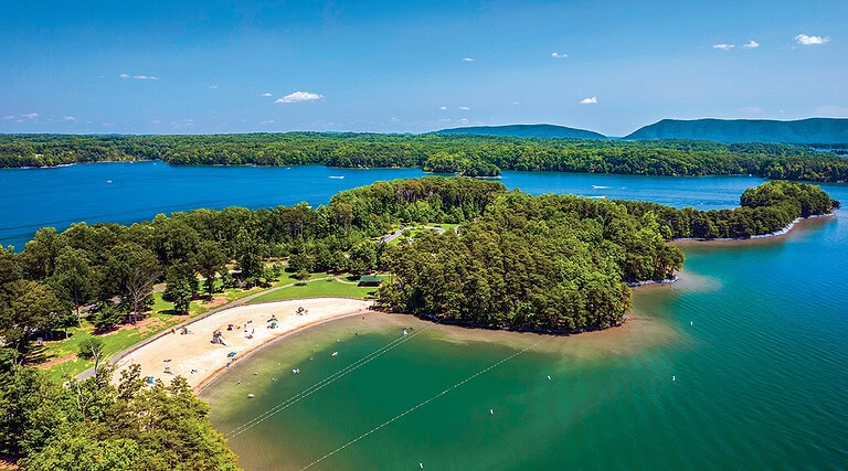
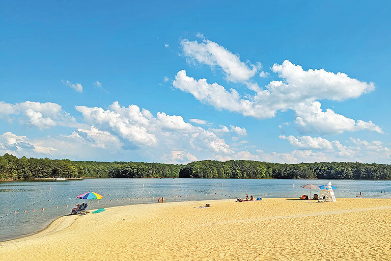
State Park Boat Rentals | R20
In season (Memorial Day weekend through Labor Day), Bridgewater Marina and Boat Rentals operates one of its three satellite operations out of Smith Mountain Lake State Park. Boat renters may pick up and drop off vessels near the park’s beach. There is no gas or other retail facilities here.
CONTACT:
540-297-3642 ![]()
1235 State Park Road, Huddleston, Virginia 24104
Bedford County
Boating
Bernard’s Landing Boat Rentals | R11
Idle inside the row of no-wake buoys to find gang docks for the condos at Bernard’s Landing plus, to the left, transient docking for local favorite Napoli by the Lake restaurant. Bridgewater Marina operates a fleet of rental boats and personal watercraft from here in season, but there’s no gas to purchase.
CONTACT:
540-721-7800 ![]()
775 Ashmead Road, Moneta, Virginia 24121
Franklin County
Boating
Parkway Marina | R8
Across the big bay from Bernard’s lies Parkway Marina, marked by an octagonal building on the point that houses a carousel (operated only for special events). Circle around that point and idle inside the no-wake markers to find a gas dock (attended 8 a.m. to 6 p.m. daily in season), launching ramp, porta potties and marina store that stocks souvenirs, life jackets, water toys and engine oil, plus a large selection of beverages (in season), including beer. SML Marine Service and Straight Line Upholstery & Canvas are accessible by water from the outer shore of Saunders’ Point.
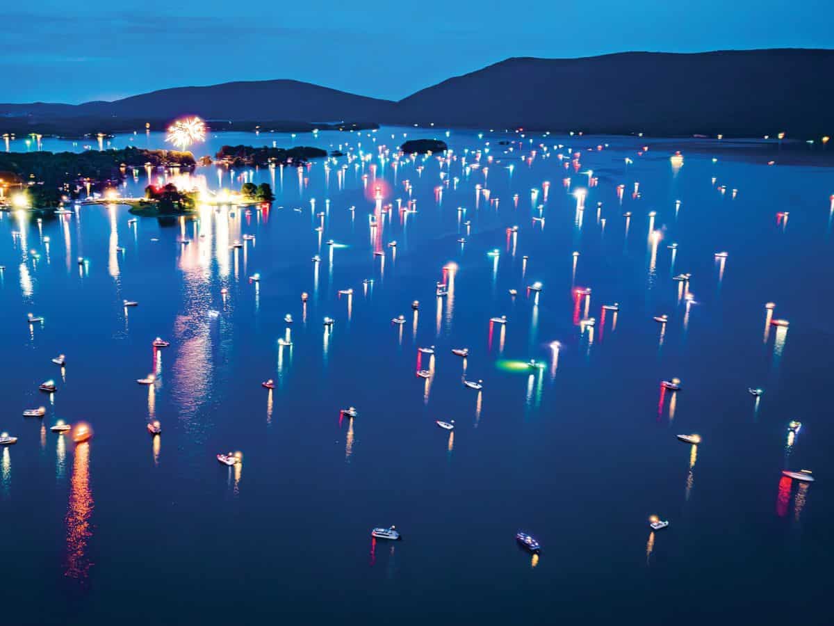
Parkway Marina Insider Tip: SML’s awesome over-water fireworks are launched from Parkway’s Saunders’ Point during July 4th weekend, so note this location if you’ll be around. The bay from which most boaters view the show is designated and enforced as a no-wake zone. See our post on SML Fireworks for all the details.
CONTACT:
540-297-4412 ![]()
16918 Smith Mountain Lake Pkwy, Huddleston, Virginia 24104
Bedford County
Boating
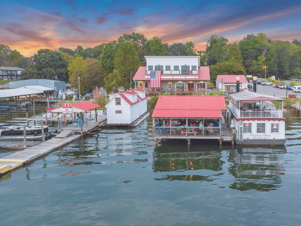
Virginia Dare Cruises and Marina
Between R22 and R20
This primarily rented-slip marina is home to the Virginia Dare sightseeing cruise boat, as well as waterfront dining favorites Portside Grill and Bar and Beacon Seafood Pub . There are ample floating docks to handle restaurant traffic (stay right of the Dare’s stern and the pay-to-use launching ramp); 24/7 gas dock is to her port side, adjacent to the over-water grill seating deck.
Virginia Dare Insider Tip: Boaters who encounter the Virginia Dare out on a cruise generally show their Southern hospitality with a toot of the horn and a wave to the guests on board. The gesture also reassures the captain that you are attuned to the Dare’s presence and course and will maintain a safe distance. Learn more on our Virginia Dare review post.
CONTACT:
540-297-7100 ![]()
3619 Airport Road, Moneta, Virginia 24121
Bedford County
Boating
The Dock at SML
Directly (but distantly) south of R6, SSE of Vista Point condos
A popular stop for gas (24/7) and fueling up your crew on appetizers, dogs, wings, sandwiches and pizza at picnic tables right on the dock. Getting there requires keeping the shallows east of Vista Pointe’s community docks well to your left as you wind back into the marina cove beyond.
CONTACT:
540-565-0222 ![]()
188 Locust Lane, Penhook, Virginia 24137
Franklin County
Boating
Lake Haven Marina | C2
Covered slips for large cruisers and some uncovered slips for smaller boats. No retail services available.
CONTACT:
540-297-7347 ![]()
15844 Smith Mountain Lake Pkwy, Huddleston, Virginia 24104
Bedford County
Boating
Craddock Creek Marina | C2
A private dockage marina with ADA-accessible bathhouse available to slip holders and guests. No gas or other retail services available.
CONTACT:
540-297-7325 ![]()
15826 Smith Mountain Lake Pkwy, Huddleston, Virginia 24104
Bedford County
Boating
Mitchell’s Point Marina | C2
An attended fuel dock, boat and water toy rentals from Smith Mountain Lake Boat Rentals, launching ramp and popular outdoor restaurant are clustered shoreside to serve tenants of the campground, as well as drop-in skippers and crews. Restrooms and showers are available at the side of the restaurant.
CONTACT:
540-484-3980 ![]()
3553 Trading Post Road, Huddleston, Virginia 24104
Bedford County
Boating
Mariners Landing | C2
Other than transient docking for patrons of The Landing restaurant, the shoreline facilities at Mariners Landing are private, for use by condo and residence owners and their guests and tenants only. In-season, this is a satellite location for boat renters from Bridgewater Marina to pick up and drop off vessels.
CONTACT:
540-238-7726 ![]()
1217 Graves Harbor Trail, Huddleston, Virginia 24121
Bedford County
Boating
Lumpkins Marina
Several coves south of B1, along the foot of Smith Mountain
Lumpkins has been a Penhook institution since SML was filled in the mid-1960s. Here you’ll find 24/7 gas and a mini-store with snacks, drinks, ice and ice cream (new for 2024). Sandy’s at Lumpkins is well known for reasonably-priced burgers and breakfast stacks of blueberry pancakes that may hold you well through lunchtime.
CONTACT:
434-927-5294 ![]()
503 Pruitt Drive, Penhook, Virginia 24137
Franklin County
Boating
Lakeside Marina
One cove beyond Lumpkins
One of SML’s very first marinas, Lakeside offers covered and uncovered slip space to tenants by contract. No retail services available.
CONTACT:
434-927-5380 ![]()
629 Lakeside Road, Penhook, Virginia 24137
Franklin County
Boating
Palmer’s Marina
Across cove from BR3
Covered slips provided by contract. No gas or other retail services.
CONTACT:
540-576-3651 ![]()
2330 Morgans Road, Penhook, Virginia 24137
Franklin County
Boating
Pelican Point Yacht Club | Above B9
Pelican Point is a private club that provides slips for in-water dockage of 134 boats, mostly sailing yachts and large cruisers. Slip holders enjoy clubhouse, pool and shower facilities and social events. Diesel fuel is available by appointment.
CONTACT:
540-576-2019 ![]()
60 Marina Point Lane, Union Hall, Virginia 24176
Franklin County
Boating
Goodhue Boat Company, Blackwater | B10A
Formerly Crazy Horse Marina, this long-time favorite is under new ownership for 2024. Situated a quarter of the way up the Blackwater, it offers an attended gas dock (not open 24/7 but shielded from boat wakes), a small store with snacks and beverages (excluding beer) and dining at Los Amigos Bar & Grill. A launching ramp is conveniently located near the pleasant beach, with ample docking for restaurant patrons. Enjoy the weekend live music from your boat, whether docked in a transient slip or just offshore. Goodhue Blackwater offers new and used boats, similar to its sister marina, Goodhue Eastlake. Rental boats and Carefree Boat Club options are also available here.
CONTACT:
540-719-0620 ![]()
400 Crazy Horse Drive, Moneta, Virginia 24121
Bedford County
Boating
Gills Creek Marina | G2
Dead ahead as you motor into the mouth of Gills Creek you’ll find a large 24/7 gas dock (with helpful attendants during business hours) and a well-stocked marina store for accessories, lake gear, beverages and ice cream treats. Several rental boats are available with advance reservations required. There’s a launch ramp beside the store and four lakeview motel rooms on the hill behind.
CONTACT:
540-721-2451 ![]()
790 Fox Chase Road, Wirtz, Virginia 24184
Franklin County
Lodging & Hotels
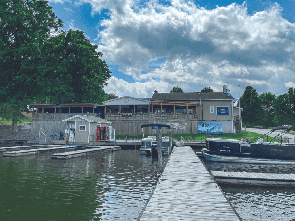
Magnum Point Marina | SE of B37
There is a pay-to-launch ramp at Magnum Point, plus covered slips for use by rental contract. The chief attraction is an indoor/outdoor restaurant that operates year-round, thanks to a sizable lakefront porch that gets enclosed and heated for the cooler months. Ample double-wide slips make docking a snap, and the restaurant is just a sloped ramp and a flight up.
Magnum Point Marina Insider Tip: Magnum Point is visible in the distance ahead and to the left as you round the 4-H Center point at B37. Don’t follow the channel farther upriver or you’ll miss it.
CONTACT:
540-576-3001 ![]()
2200 Old Salem School Road, Union Hall, Virginia 24176
Franklin County
Boating
Smith Mountain Lake boat ramps / launches are listed in order from the most northern launch on the Roanoke River (at navigation marker R87) to the most southwestern launches on the Blackwater River (B12) and Bull Run (BR3).
Hardy Ford Boat Launch
South of channel marker R87
14051 Hardy Rd, Vinton, VA 24179
Hale’s Ford Boat Launch
East of marker R29
Meadow Point Dr, Moneta, VA 24121
Oak Grove Boat Launch
Southwest of marker R28
Oak Grove Cir, Moneta, VA 24121
SML State Park Boat Launch
Northeast of marker R19
Huddleston, VA 24104
Anthony Ford Boat Launch
Southwest of marker R6
Co Rd 953, Penhook, VA 24137
Penhook Boat Launch
South of marker BR3
State Rte 966, Penhook, VA 24137
Scruggs Boat Launch
At marker B12
1755 Dudley Amos Rd, Moneta, VA 24121
Free, Printable Map of SML Marinas & Boat Ramps

Jerry Hale
STAFF WRITER
When he’s not writing about the Smith Mountain Lake, you might just find Jerry out wake surfing or just idling through its coves, practicing guitar or banjo on his deck at the Cottages of Contentment Island, playing steel drums or volunteering with LCM, Trinity Ecumenical Parish, Neighbors Helping Neighbors or the SML Charity Home Tour.