SML Watershed 101: Where Smith Mountain Lake’s Water Comes From
This page may contain affiliate links. If you click and purchase, we may earn a small commission at no extra cost to you. Read our full disclosure policy.
Understanding the watershed that feeds and protects Smith Mountain Lake.
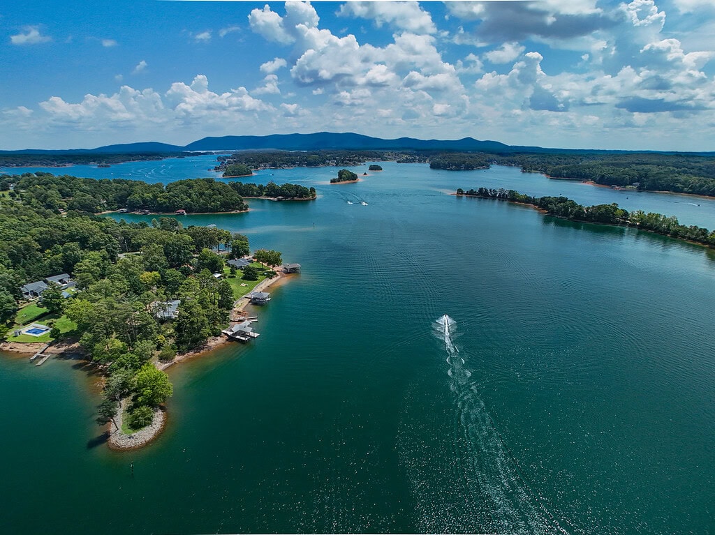
The ongoing drought has many Smith Mountain Lake residents asking the same question: Where does the lake’s water come from?
The answer begins far beyond the shoreline in a vast watershed stretching across much of western Virginia and eventually reaching the Atlantic Ocean.
Watersheds, often called basins, are a collection of water sources, both surface and groundwater, that gather water from aquifers, wetlands, tributaries, streams, rivers and lakes.
The water travels, often great distances, to an outlet into an ocean.
Watersheds exist at every scale, from a small creek behind your house to some of the largest river systems on Earth. The greatest in terms of geographical coverage and volume of water moved is the Amazon River Basin covering more than 7 million square miles.
The Mississippi River Basin covers more than 3.2 million square miles and is the third largest in the world. These huge watersheds encompass hundreds of sub-watersheds. Think of these areas like nesting bowls. Each watershed starts out as a tiny drainage area, leading to bigger and bigger collection systems.
The Roanoke River watershed spans nearly 9,600 square miles and runs approximately 400 miles through 15 counties in Virginia and 19 counties in North Carolina. Ultimately, it reaches Batchelor Bay, which is part of the Albemarle Sound, and then enters the Atlantic Ocean. It often surprises people to learn that SML and the Roanoke River do not drain to the James River and Chesapeake Bay.
The Roanoke River begins as two humble forks, the North and South. The North Fork begins in Roanoke County, travels south to Montgomery County and then back north. The South Fork joins the North in Elliston, halfway between Christiansburg and Salem.
From the point where the forks unite as one river, the Roanoke makes its way north and then east around the Salem and the Roanoke City corridor. It then turns southeast where the Niagara Dam is situated. Not far downstream is the beginning of Smith Mountain Lake.
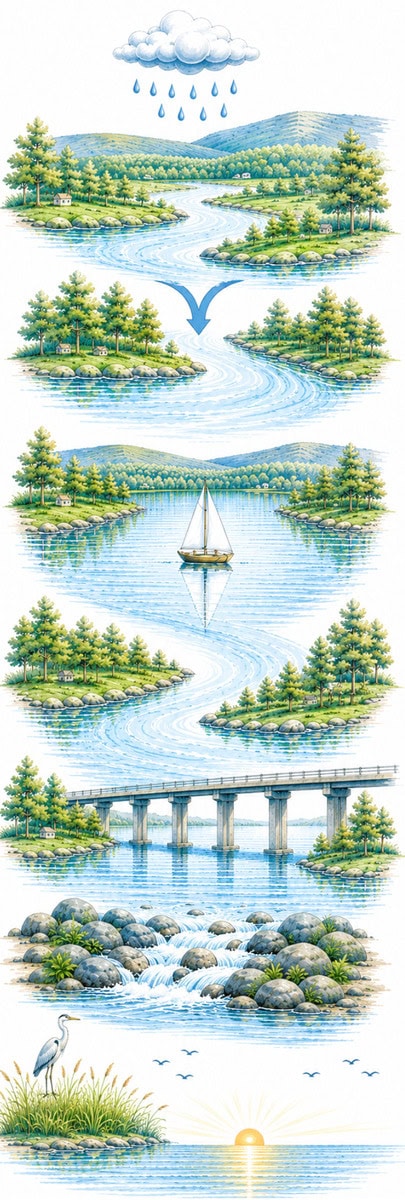
From the Blue Ridge Mountains to the Atlantic Ocean:
- Rain — Rain falls in the Blue Ridge Mountains and throughout the watershed.
- Blue Ridge Mountains — Rain and snowmelt flow into creeks and streams that drain the valleys.
- North Fork + South Fork — Two forks come together in Elliston to form the Roanoke River.
- Roanoke River — The river flows north and then east toward Smith Mountain Lake.
- Smith Mountain Lake — Fed by many tributaries from the large surrounding watershed, the river flows through Smith Mountain Dam and into Leesville Lake.
- Staunton River — The river is known as the Staunton River for an 81-mile stretch.
- Kerr Reservoir (Buggs Island) — The Dan River joins here, and the river continues its journey.
- Lake Gaston — The river flows along the Virginia–North Carolina border.
- Roanoke Rapids — Water flows over the famed rapids near Roanoke Rapids, N.C.
- Albemarle Sound — The river enters Batchelor Bay and the Albemarle Sound.
- Atlantic Ocean — The journey ends as the water reaches the Atlantic.
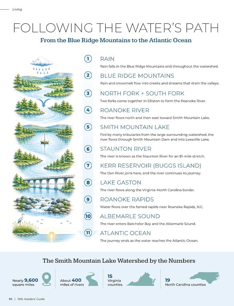
The Smith Mountain Lake watershed by the numbers: nearly 9,600 square miles, about 400 miles of rivers, 15 Virginia counties and 19 North Carolina counties.
The drought that has plagued Virginia since the summer of 2025 illustrates why rainfall is so critical to our region. Droughts can have unexpected effects on lakes, even those distant from the rainfall source.
When it rains in one location, the water may not immediately reach lakes or rivers due to evaporation, absorption or slow runoff. Additionally, a drought can decrease groundwater levels, impacting streams and rivers feeding lakes that are kilometers away. Consequently, less rain water can lead to lower lake levels, affecting aquatic life and recreation. This effect is felt throughout the Roanoke watershed.
We’ve all experienced summer thunderstorms that dump inches of rain in an hour at SML. But not all of these storms rain across the entire area. A massive boomer in Huddleston could leave Union Hall sunny and dry.
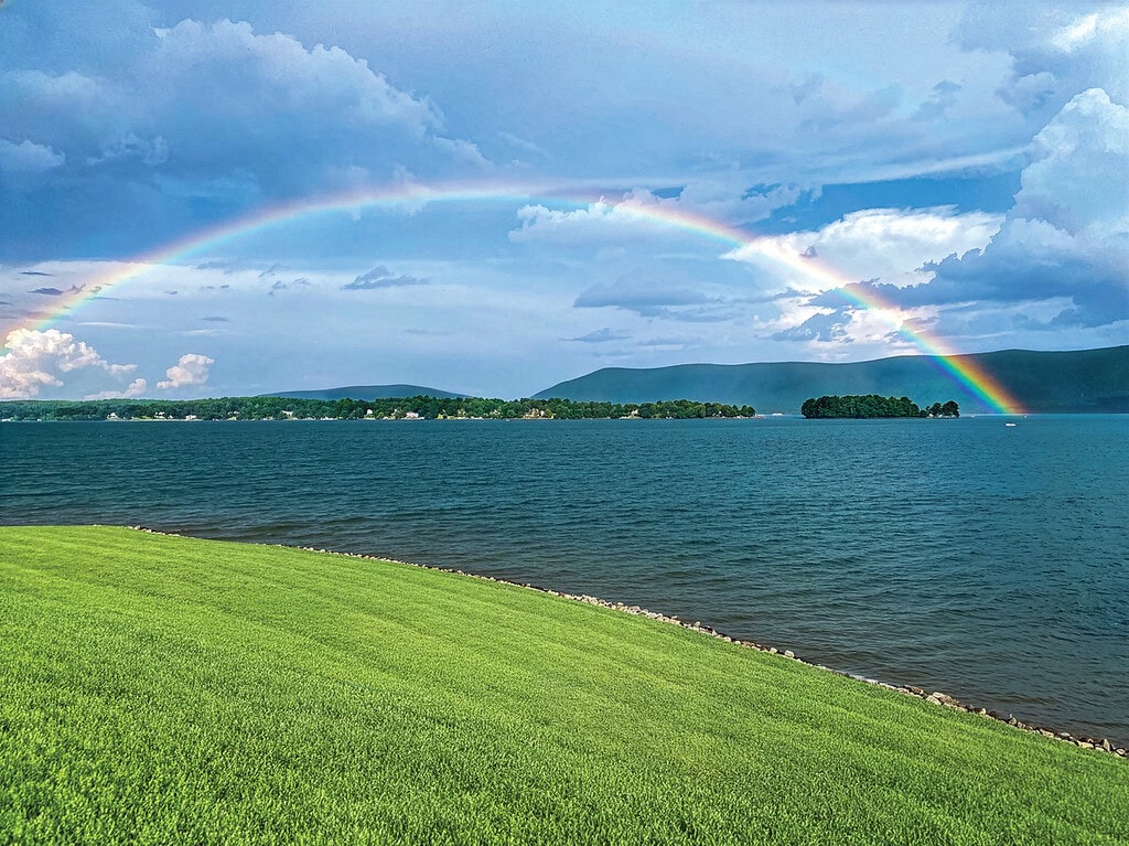
The same goes for rainfall in the upper portions of the watershed. Rain coming up the Blue Ridge often stays along the mountains and doesn’t make it over to the lake, but the rain that fell in Salem and Roanoke will contribute to the overall flow in the system.
River gauges operated by the US Geological Survey track river flows to aid in flood planning, drinking water supplies and forecasting. Very few gauges exist in the Roanoke area. This lack of data makes forecasting drought conditions difficult and imprecise.
Water is directed by topography. It flows around mountains, down slopes and follows gravity. The water quality is directly affected by the land it travels over or through.
Forested watersheds with very little disturbance are always going to have better quality water than watersheds characterized by urban activities, land clearing or other uses.
Upstream impacts on water quality can travel far from their source as the watershed continues to gather water on its way to its ultimate outlet.
Lake residents and visitors can help protect the health of Smith Mountain Lake’s sub-watersheds by:
- Maintaining landscape buffers of shrubs and native plants along the shoreline to slow storm water runoff and help filter pollutants before they reach the lake.
- Using lake-friendly lawn and landscape products to reduce the amount of unwanted chemicals entering the water.
- Cleaning up pet waste to help keep bacteria and other contaminants out of the lake.
Often major impacts to water quality are outside the control of any homeowner. State and federal regulations that prescribe watershed protective measures during construction, land clearing, forestry activities and land use conversion help reduce impacts to water quality.
Water doesn’t recognize town, county or state lines. Every stream, creek, wetland and river is connected, carrying water from the mountains and valleys into Smith Mountain Lake before continuing downstream through the Roanoke River watershed.
Understanding where the lake’s water comes from — and where it eventually goes — is an important reminder that protecting our watersheds is a shared responsibility. The choices we make today help preserve the health and beauty of Smith Mountain Lake for generations to come.

Read more articles from the Smith Mountain Lake Association on keeping SML clean and healthy.

Keri Green
GUEST AUTHOR
Keri is an environmental consultant and chair of the Lake Quality Council for the Smith Mountain Lake Association, where she volunteers her time to protect and preserve the lake’s water quality through science, education and community stewardship.